
Mt. Tamalpais State Park hiking to peak
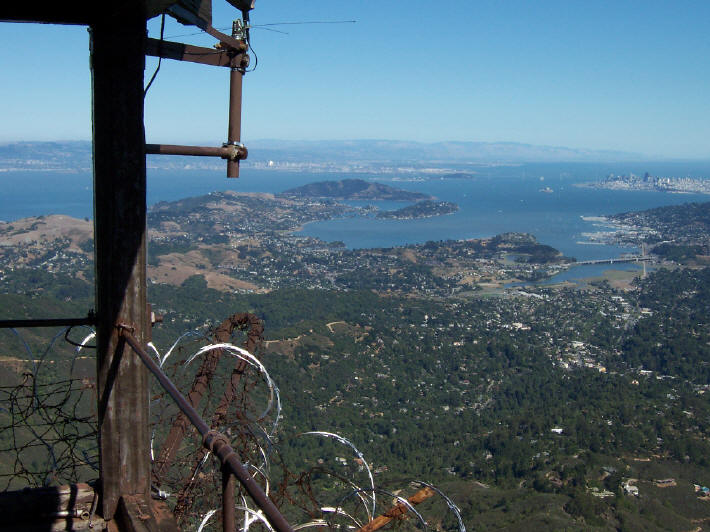
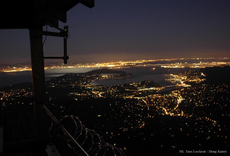
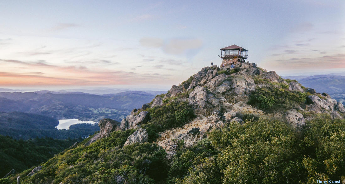
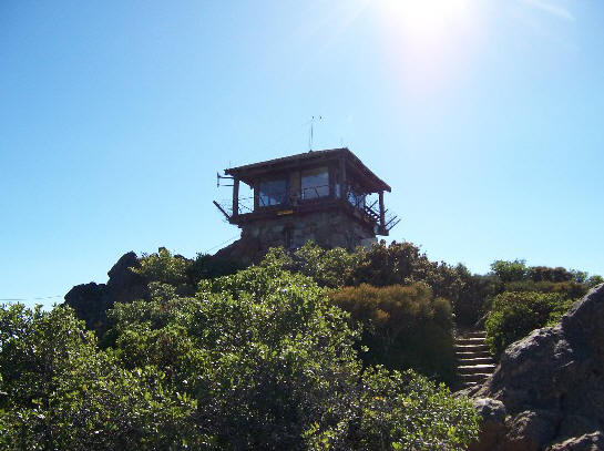
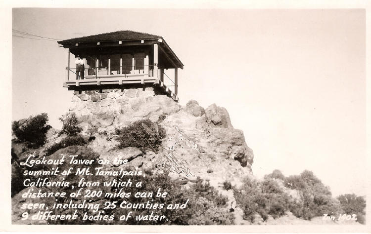
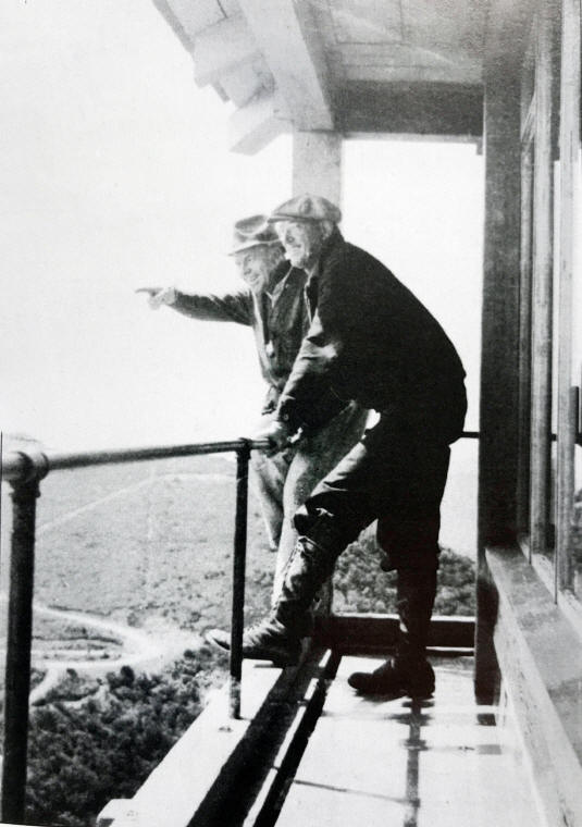
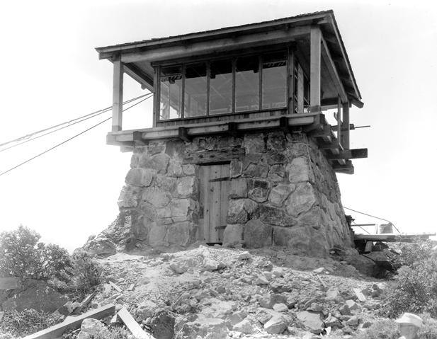
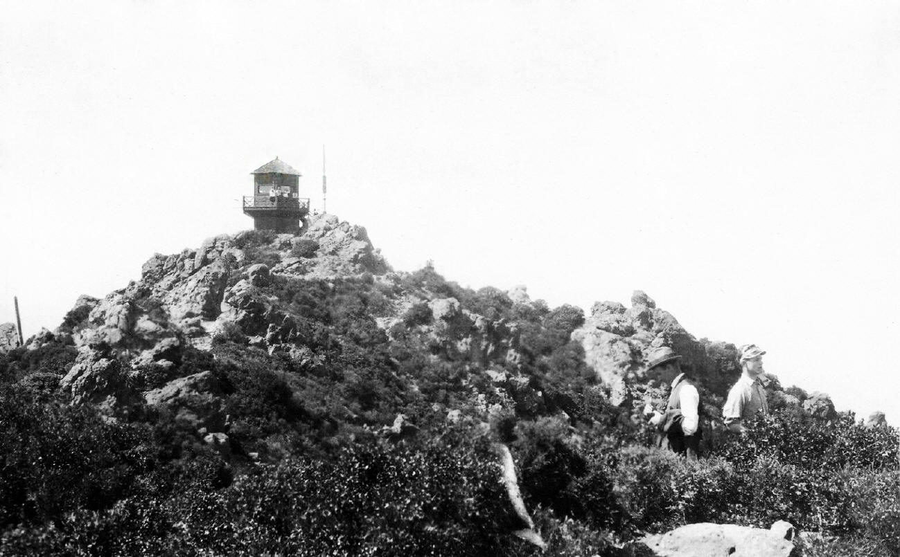
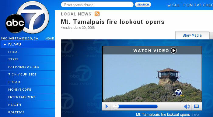
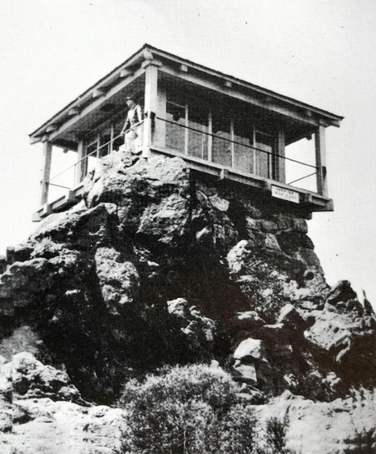
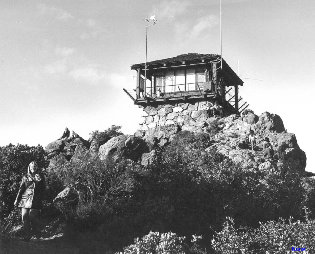
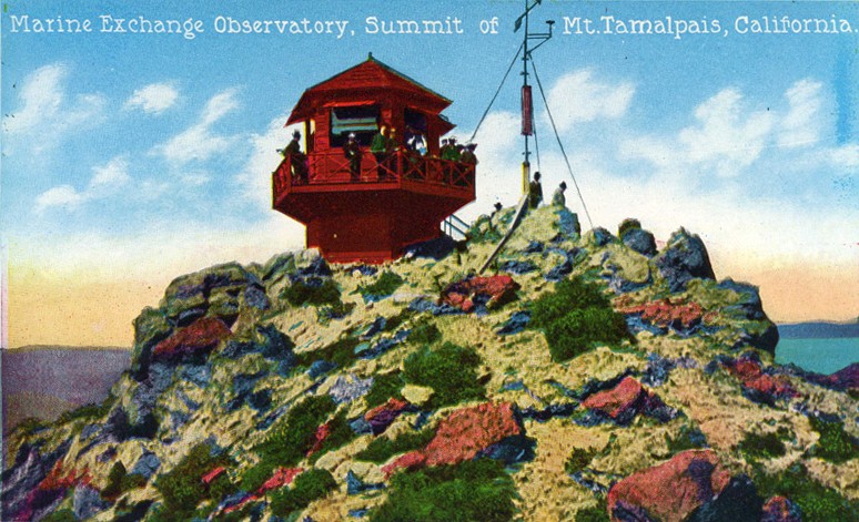
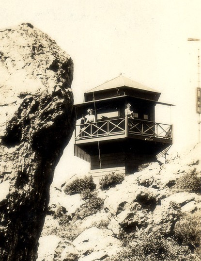
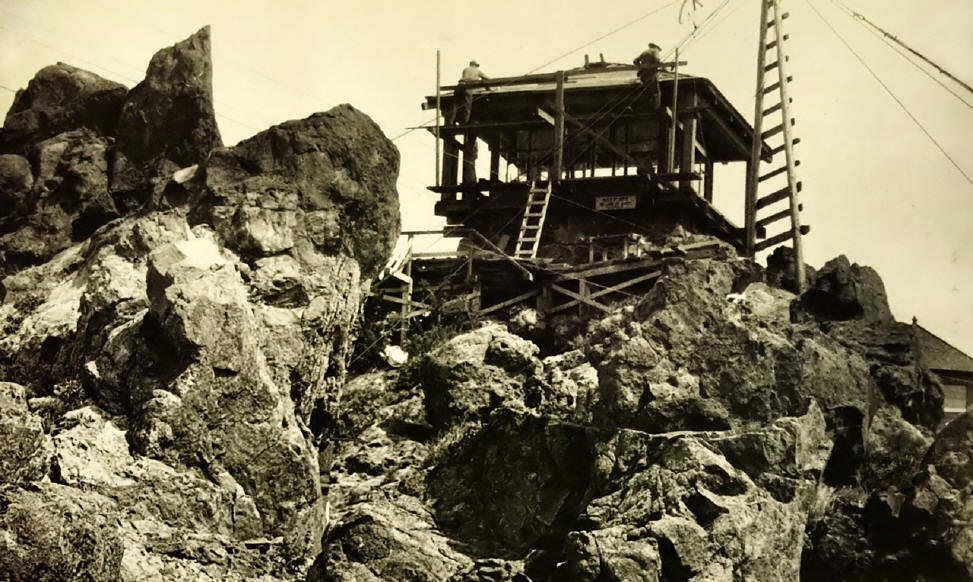
Historic Photos of Mt. Tamalpais Fire Lookout
About Mt. Tamalpias
Mount Tamalpais (“Mount Tam”) is a peak in Marin County, California, USA, often considered symbolic of Marin County. Its name, first recorded in 1845, is said to be derived from a Miwok word meaning “Sleeping Maiden”, on the grounds that the silhouette of the mountain can be seen as the shape of a sleeping girl; the point of view from which this is obvious is not recorded. However, when viewed from the East Bay, in the vicinity of San Pablo, the mountain does give a semblance of a reclining woman, with the two peaks as breasts, the north slope as her trunk, hips, legs, and the south slope as her head.
Contents
* 1 Recreation
* 2 Hiking
* 3 Mountain Biking
* 4 Geology and Climate
* 5 History
* 6 External links
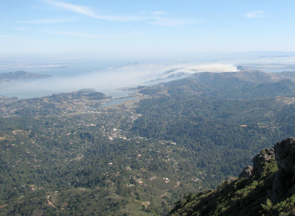
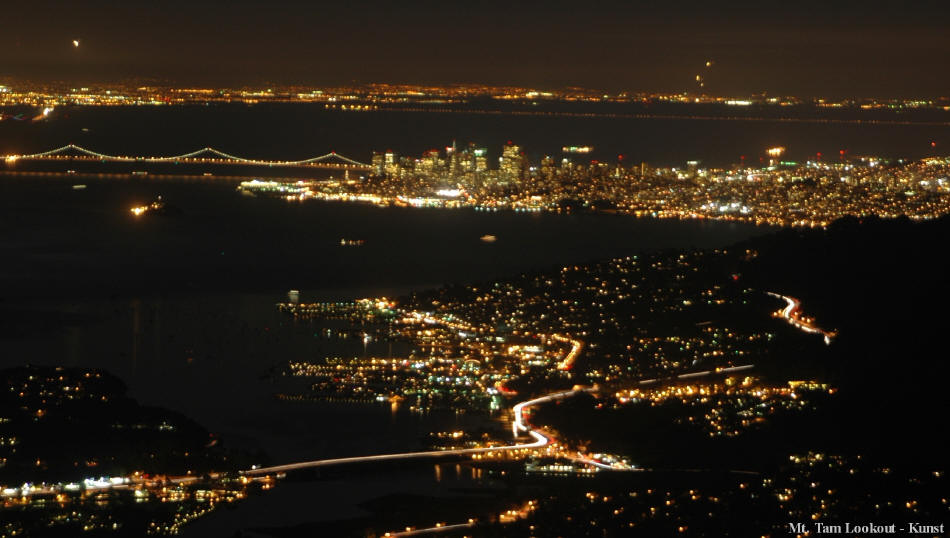
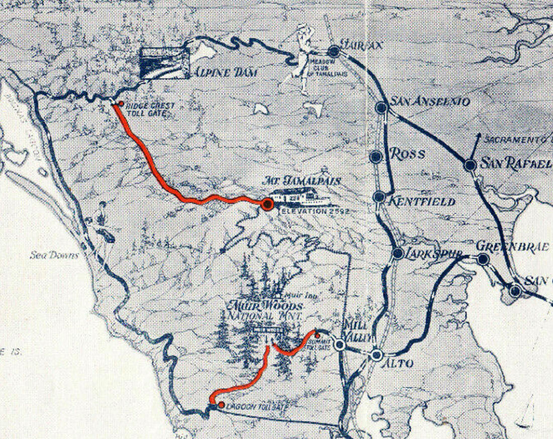
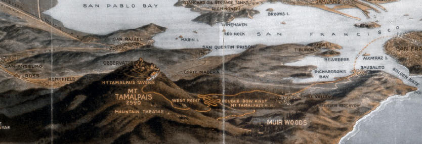
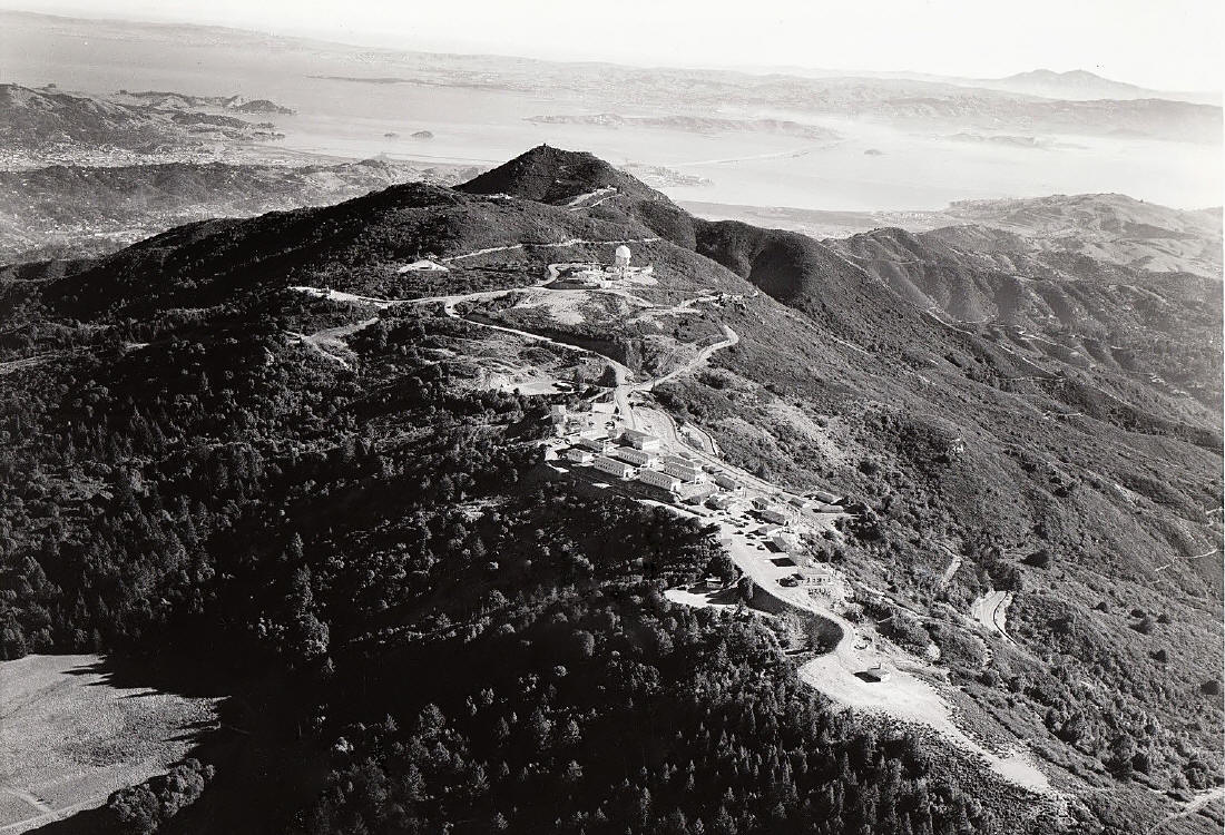
The mountain is the main feature of the Mount Tamalpais State Park, Muir Woods National Monument, and contiguous Marin Municipal Water District (MMWD) watershed recreational area, and adjoins the Golden Gate National Recreation Area and Point Reyes National Seashore providing nearly 40 miles (64 km) of continuous publicly accessible open space. It is a popular hiking, picknicking, mountain and road cycling, horseback riding, and hang-gliding destination for residents of the San Francisco Bay Area, with over 100 miles of trails and fire roads. With numerous trailheads, a well-networked trail and road system, and hikes of greatly varying length and difficulty, the mountain offers a compelling range of attractions. MMWD maintains several resevoirs on the north slopes of Mount Tam: lakes Alpine Lake, Kent Lake, Bon Tempe, and Lagunitas.
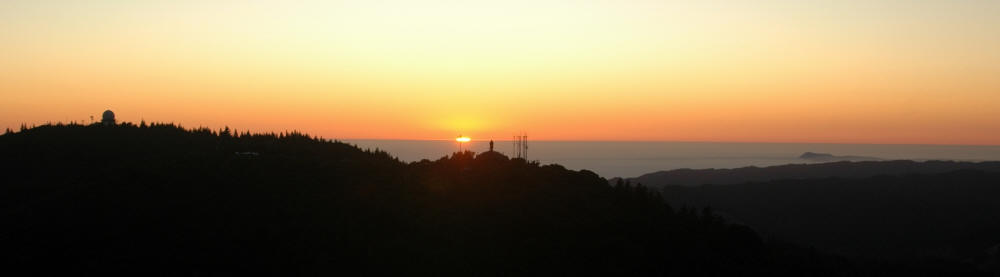
The western slopes of the mountain descend to the Pacific Ocean at Stinson Beach, California. The annual Dipsea Race traverses the mountain from Mill Valley to Stinson Beach. Though backpack camping isn’t allowed, a walk-in camp exists at the Pan Toll ranger station. Trailhead parking within Mt. Tamalpais State Park is available generally with a self-service fee. The scenic Ridgecrest Blvd. running along the ridgeline between the Rock Spring trailhead and Fairfax-Bolinas Road, with panoramic views of the summit, Pacific, San Francisco, Bolinas, and Point Reyes, is featured in many auto and other video and print advertisements, as well as being the local hang-gliding launch point. Mount Tam is also home to the Edgewood Botanic Garden and to the Cushing Memorial Amphitheater where musical productions are performed every year by the Mountain Play Association. Monthly astronomy viewings and lectures are held at Rock Springs and Mountain Theater April through October.
Hiking
Among the more popular trailheads on and about Mt. Tam are:
MMWD:
* Bon Tempe Trailhead: parking (fee), toilet
* Carson Falls: parking
* Cataract Falls: parking
* Deer Park: parking, water, toilets
* Fairfax-Bolinas Rd. summit: limited parking
* Phoenix Lake Trailhead: parking, water
* Rock Spring Trailhead: parking (fee), water, toilets
* Sky Oaks Trailhead: parking (fee), water, toilets, phone
* West Blythdale Ave: limited parking
Mount Tamalpais State Park:
* Boot Jack Camp: parking (fee), water, toilets
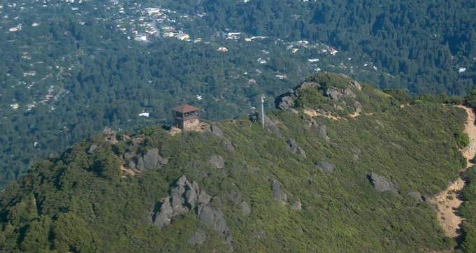
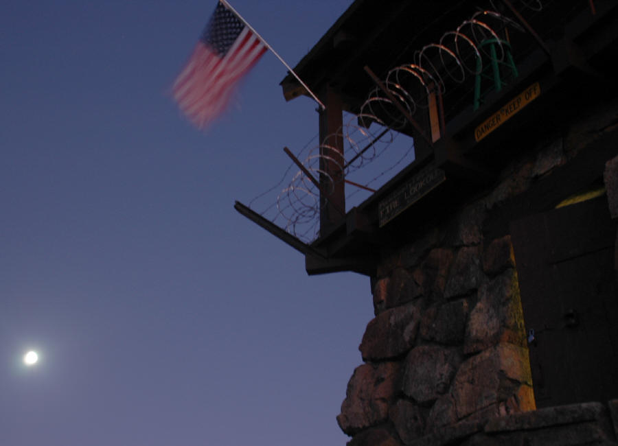
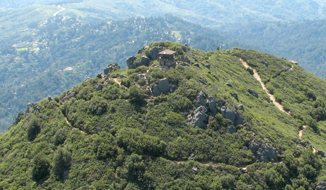
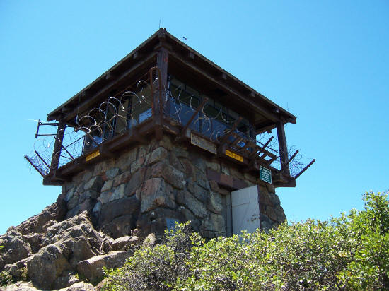
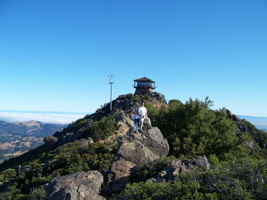
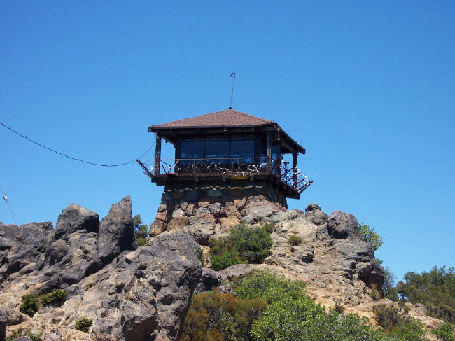
* East Peak: parking (fee), water, toilets, concession stand, phone
* Mountain Home: parking, water, toilets, phone
* Muir Woods Rd.: limited parking
* Pantoll: parking (fee), water, toilets, camping, phone
* Stinson Beach: parking, water, toilets, phone, stores
Muir Woods National Monument
* Muir Woods Road Trailhead: parking (fee), water, toilets, phone, stores
[Bay Area Hiker – North Bay Hikes]
Many say that the sport of mountain biking originated on Mt. Tamalpais (see section on History of Mountain Biking)
The easiest approach is from the town of Ross, taking Lagunitas Rd. to Phoenix Lake (limited parking at Natalie Coffin Greene Park). Circle the lake to the right and take the easy grade that switches back to the mountain, via the paved road to Lake Lagunitas. Go around the right side of Lake Lagunitas to find a wide, slightly steeper trail to the mountain.
Mill Valley provides another easy approach to the southern slopes of Mt. Tam via Eldridge Ave. to the Railroad Grade, a wide gently-sloped fire road easy enough for intermediate riders.
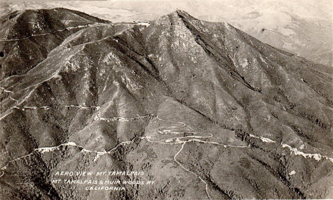
Mount Tamalpais is part of the Coast Ranges, the result of uplift, buckling, and folding of the North American plate as it slides along the Pacific Plate near the San Andreas fault zone. Major rockforms include serpentine, particularly outcroppings near the summit and on the north side. During cold, wet winter storms, the mountain also regularly gets some snowfall, sometimes as much as 6 inches overnight in February 2001, and March 2006. With its hight, various faces, and proximity to the ocean and bay, microclimates vary, generally being temperate but ranging from cool and foggy in lower ocean-side redwood-forested valleys to hot and dry on the manzinita slopes, cool and breezy at the summit, and shady on the heavily Douglas Fir forested north slopes near Alpine Lake.
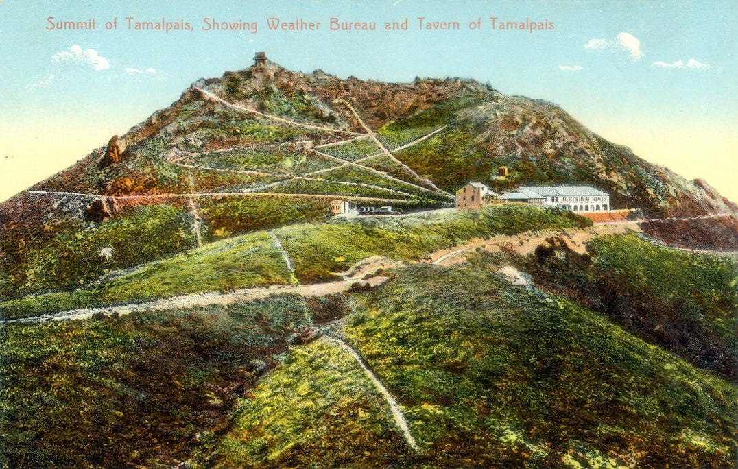
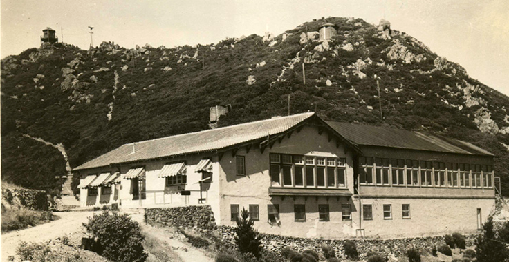
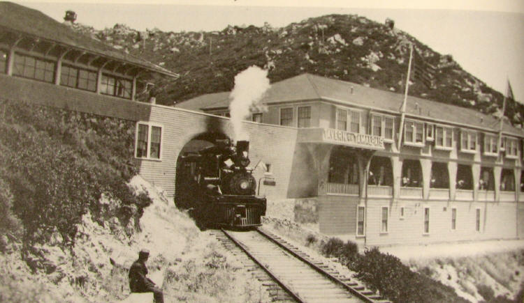
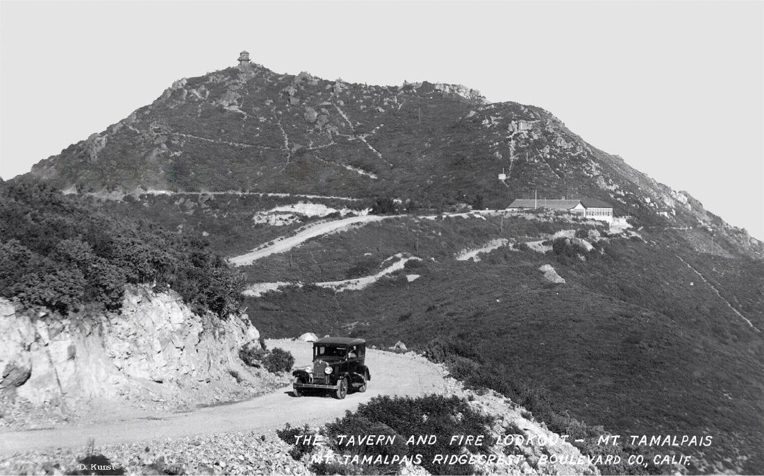
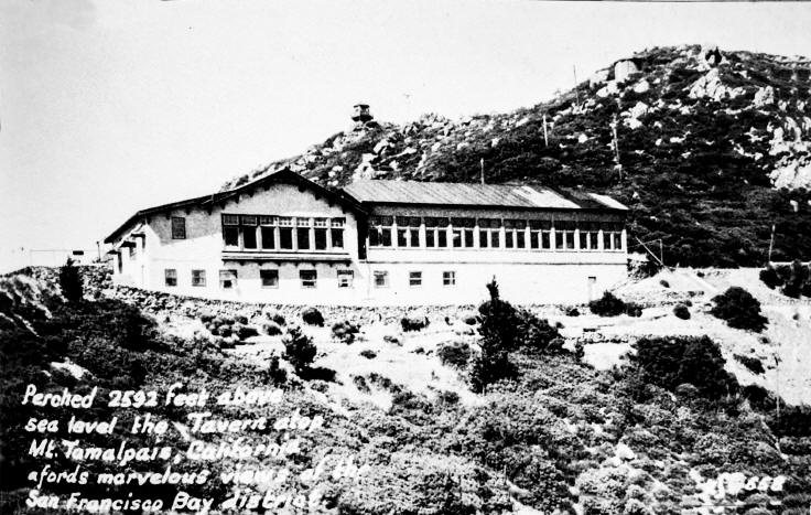
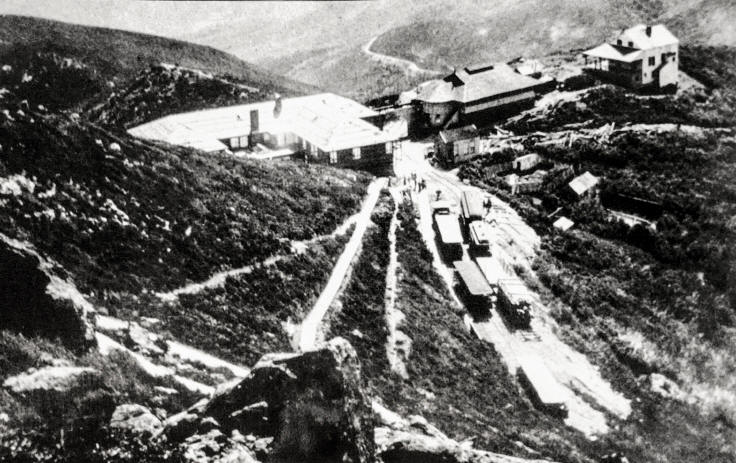
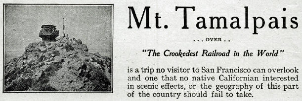
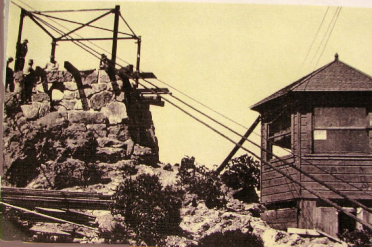
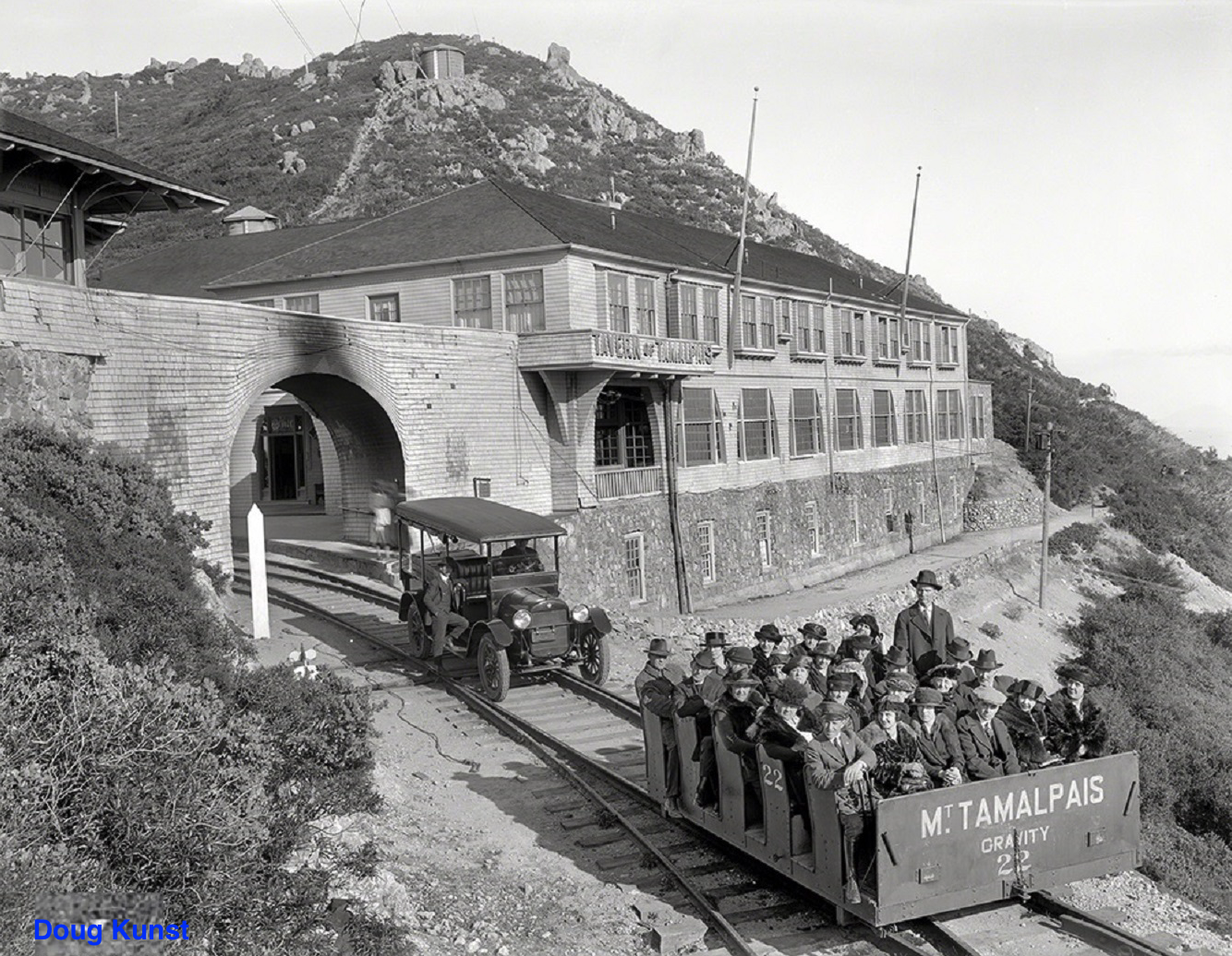
Tamalpais was home to the Mount Tamalpais Scenic Railway, also known as “The Crookedest Railroad in the World”, a railroad which meandered its way up to the peak from downtown Mill Valley until the construction of the road to the peak, and the gaining popularity of automobiles.
The peak and its surrounding areas are the birthplace of mountain biking. There, in the 1970s, early mountain bikers such as Gary Fisher, Otis Guy, Charlie Kelly and Joe Breeze roamed on their two-wheeled steeds.
Mt. Tamalpais State Parks
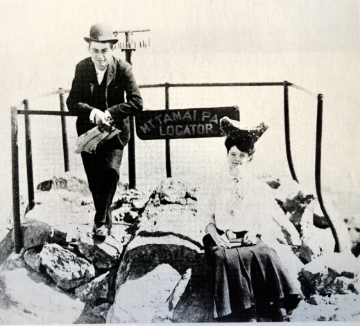
Mt. Tam History
Hiking Astronomy
Mt. Tamalpais State Park
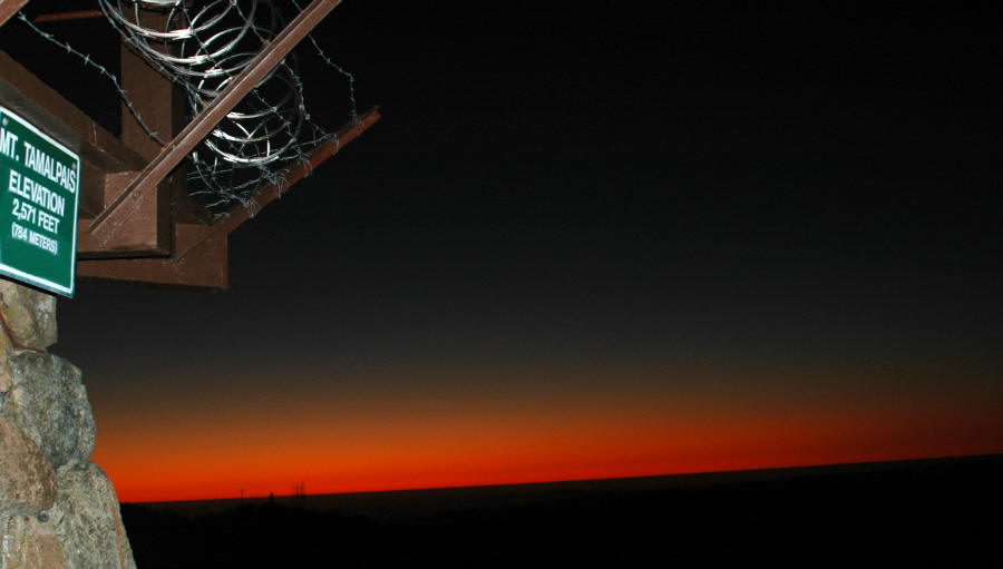
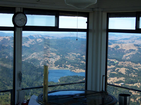
Just north of San Francisco’s Golden Gate is Mount Tamalpais State Park, 6,300 acres of redwood groves and oak woodlands with a spectacular view from the 2,571-foot east peak. Combined with other spaces in Marin – including the Golden Gate National Recreation Area, Marin County Open Spaces, Marin Municipal Water District, and some privately held lands – Mt. Tamalpais itself is said to cover nearly 25,000 acres. Located in the heart of Marin County, offers a wealth of activities, including hiking, biking, camping, and much more! In addition, Mt. Tamalpais State Park also offers guided hiking programs, astronomy lectures and stargazing sessions, and even public storytelling events – all free and open to the public.
Announcements
Mt. Tamalpais Clear Sky Clock
Coastal Miwok Indians lived in the area for thousands of years before Europeans arrived. In 1770, two explorers named the mountain La Sierra de Nuestro Padre de San Francisco, which was later changed to the Miwok word Tamalpais.
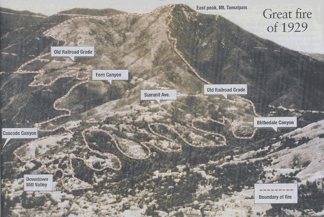
With the Gold Rush of 1849, San Francisco grew and more people began to use Mount Tamalpais for recreation. Trails were developed and a wagon road was built. Later, a railway was completed and became known as “The Crookedest Railroad in the World.” It was abandoned in 1930 after a wildfire damaged the line.
North of San Francisco’s Golden Gate. From Highway 101 take Highway 1 to the Stinson Beach exit and follow signs up the mountain.
Facilities and Activities
Hiking and Bicycle Trails: More than 50 miles of trail are within the park and connect to a larger, 200-mile-long trail system. Bicyclists are challenged by the twisting road to the top of the park’s summit.
The park has the Bootjack Picnic Area with tables, stoves, piped drinking water and flush toilets.
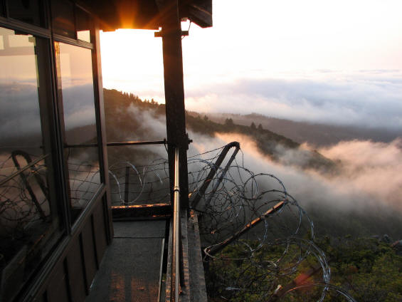
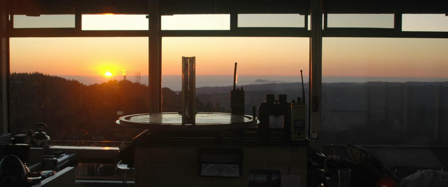
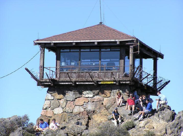
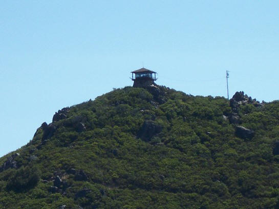
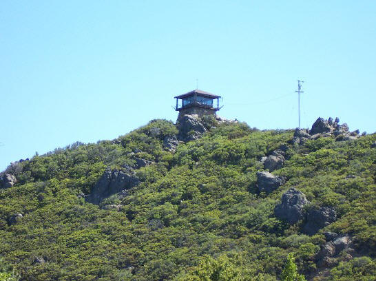
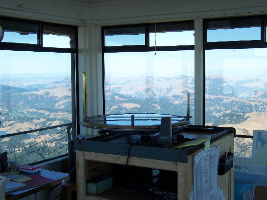
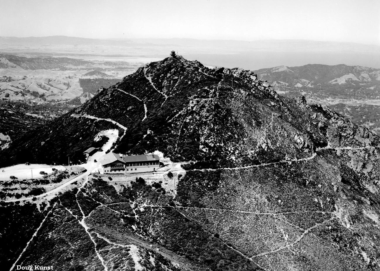
The East Peak Summit features a visitor center and a refreshment stand that are usually only open on weekends (during the summer, the refreshment stand is open daily). Phone, picnic tables and fully accessible restroom are also available.
The Mountain Theater (a.k.a. The Cushing Memorial Theater) in the park was constructed by the Civilian Conservation Corps in the 1930s. The natural-stone amphitheater seats 3,750 people and features the Mountain Play each spring, produced every year since 1913.
Seasons/Climate/Recommended Clothing
Summer and spring are warm, fall and winter can be cool. Layered clothing is best.
Mount Tamalpais SP
State Park
Ranger Station located in the park.
Just north of San Francisco’s Golden Gate is Mount Tamalpais, has redwood groves and oak woodlands with a spectacular view from the 2,571-foot peak.
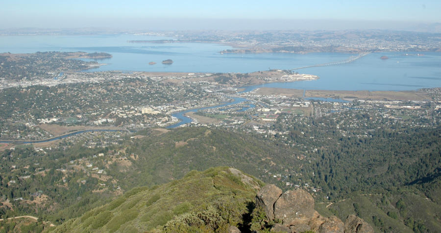
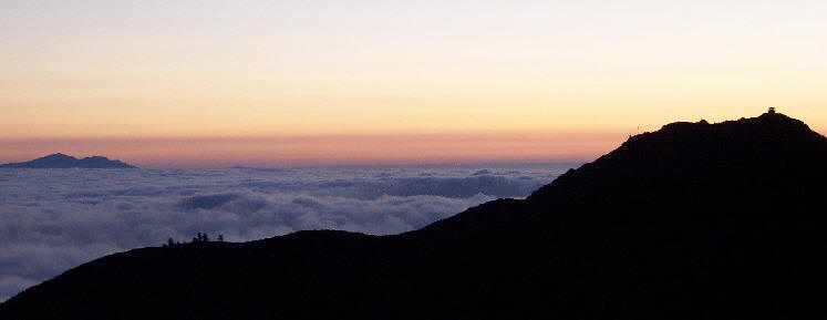
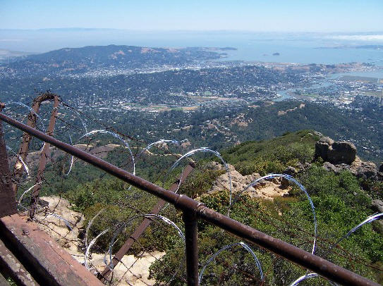
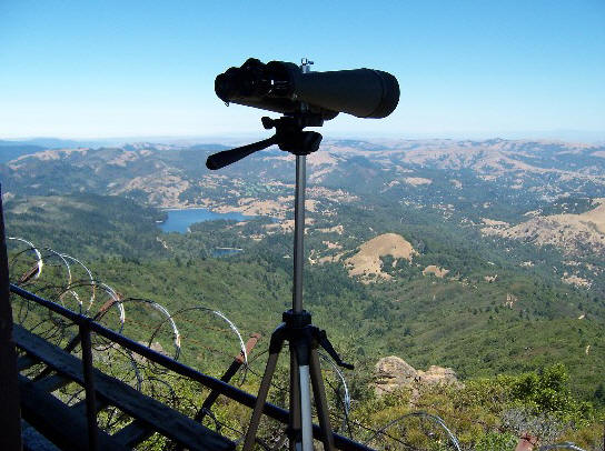
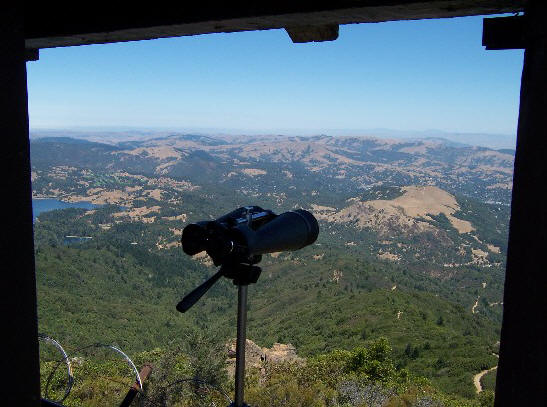
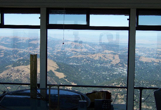
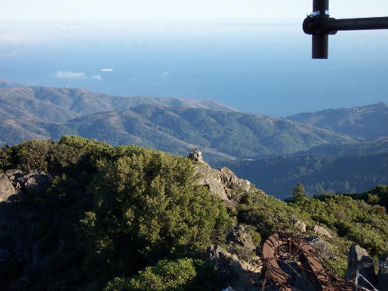
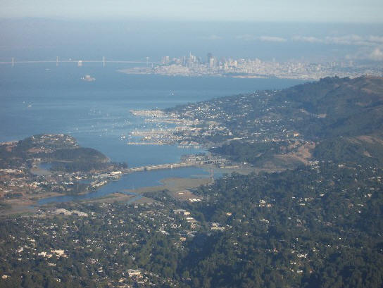
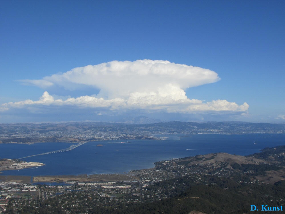
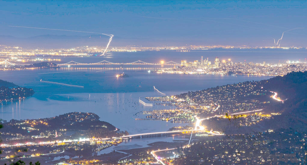
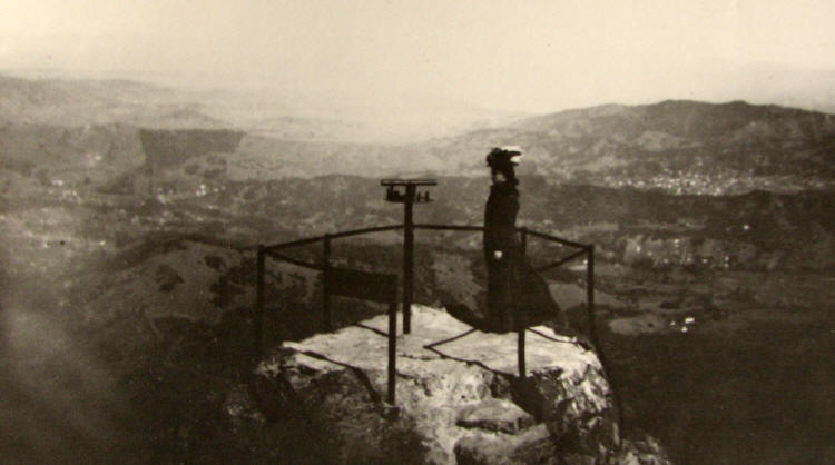
On a clear day, visitors can see the Farallon Islands 25 miles out to sea, the Marin County hills, San Francisco and the bay, hills and cities of the East Bay, and Mount Diablo. On rare occasions, the Sierra Nevada’s snow-covered mountains can be seen 150 miles away.
Mt. Tam Hiking Trails:
Thanks to the early trail-building efforts of the Tamalpais Conservation Club, as well as later efforts by the CCC during the 1930s, more than fifty miles of trail explore the state park that, thanks to continued conservation efforts, now exceeds 6,300 acres. Park trails connect to two hundred (!) more miles of trail that lead through the wooded watershed of the Marin Municipal Water District, and over to Muir Woods National Monument and Golden Gate National Recreation Area. One good place to start is at the trailhead at the Mountain Home Inn on Panoramic Highway. From Highway 1 in Mill Valley, veer right on Panoramic Highway, ascending a few miles to Mountain Home Inn and a parking area.
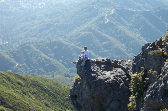
The hike up Mt. Tam from Mountain Home Inn to East Peak summit via Railroad Grade and Fern Creek trails is 6 miles round trip with 1,300-foot elevation gain. Motorists can drive to within 0.3 mile of the summit, but hiking is a more rewarding way to go, particularly on trails like Railroad Grade and Fern Creek, which offer a little bit of everything: dense stands of laurel, open grassland, oak-dotted knolls, a canyon full of redwoods and ferns. The down hike from Mountain Home Inn to Pantoll Ranger Station via Alice Eastwood Road and Bootjack Trail is 4.5 miles one way, a gorgeous ramble through the redwoods which descends to Redwood Creek, follows that vigorous watercourse, then climbs a bit to Pan Toll Ranger Station. The hike from Pantoll Ranger Station to Stinson Beach is 3 miles one-way with 1,100-foot elevation loss. For many walkers, Steep Ravine is a favorite mountain path; it’s wet, shaded, remote. Redwoods, ferns, and mosses add to the feeling of walking through a rain forest.
Steep Ravine is, as its name suggests, a steep descent, accompanied by stair steps, and even a ladder. The path intersects Dipsea Trail, which you can use to loop back to the trailhead, or follow to Stinson Beach
The Rocky Point-Steep Ravine Environmental Campground, located on a coastal bluff about one mile south of Stinson Beach, offers six primitive campsites and ten of the so-called Steep Ravine Cabins, built in the 1930s as a family retreat for Congressman William Kent. Camps and cabins are very popular and reservations highly recommended.
Pantoll Campground, located on Panoramic Highway, includes 16 family campsites located a short walk from the parking area. Pantoll Ranger Station, located off Panoramic Highway, dispenses maps and the latest park and trails information, and has an adjacent picnic area. Bootjack Picnic Area is located on the Panoramic Highway just east of Pantoll.
East Peak Summit features a picnic area, snack stand and the park visitor center.
Mountain Theater, a lovely stone amphitheater built by the Civilian Conservation Corps during the 1930s, is a popular venue for performances and special events.